Out-of-this-world landscapes and panoramas make Namibia a photographer's dream destination. While not as much of a wildlife destination as other countries, Namibia makes up for this with phenomenal scenery, cultures and activities.
Namibia is a desolate and largely uninhabitable country, well-known mainly for its deserts and coastline. However, there is far more to the destination.
Namibia is home to some fascinating people, and in the right season, can provide you with some of the best game viewing on the continent.
When travelling Namibia, the distances are vast, and often you will go without seeing another vehicle, or person, for hours.
Around every bend of the road awaits another breathtaking landscape, with wide open spaces and incredible colours giving you photo opportunities at all times of day.
Below are a few of the popular areas frequented by travellers to Namibia, and they are places which will remain in your memories forever:
One of the most scenic areas of Namibia, situated roughly in the centre of the country, Damaraland has a vast range of landscapes and experiences to offer.
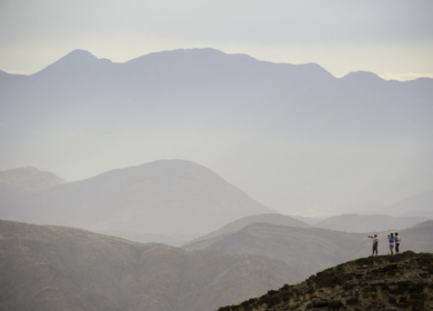
With enormously wide open spaces, endless wastelands, and some beautiful mountains and inselbergs, Damaraland can occupy a number of days of a Namibian itinerary. Named after the Damara people who were moved into the area during the years of apartheid in South Africa, you can enjoy cultural experiences with the local tribes along your journey.
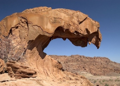
Namibia is a geologist's delight, and with prehistoric water courses, massive granite koppies and deep gorges, Damaraland has some fascinating features which will keep the camera occupied.
Meaning "Place of Dry Water," Etosha is the best wildlife destination in Namibia, and at certain times of year can rival any game reserve in Africa.
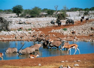
Formed around the enormous and beautiful Etosha Salt Pan, the national park is home to an incredible number of species, including black rhino, the endemic black faced impala, thousands upon thousands and springbok, zebra, wildebeest and the majestic gemsbok (oryx).
During the dry season, these animals are drawn in their masses to the very few remaining water holes, and it is not uncommon to see a few hundred of several different species all in one location at one time.
Being roughly a 5 hour drive from Windhoek, Etosha National Park is also accessible by air, and is definitely a highlight of a Namibian safari itinerary.
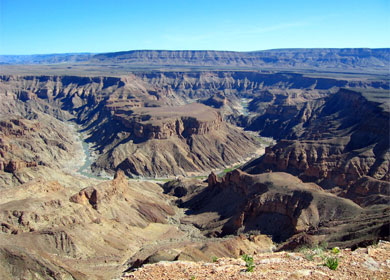
The Fish River Canyon - 161 km long, 27 km wide and up to 550m deep - is the second largest canyon worldwide after the Grand Canyon in the USA . The Canyon forms part of the state-run Ais-Ais Richtersveld Transfontier Park.
The Fish River Hiking Trail can be conducted during the months April – September and can be completed within 4 to 5 days, depending on fitness. It covers a length of 85 km and the descent into the Canyon is only allowed for hikers doing the trail. Day-visitors are not allowed to climb into the Canyon.
The Fish River has its source in the eastern parts of the Naukluft Mountains. After about 200 km the river flows into the Hardap Dam.
After being retained by the Hardap Dam, the Fish River does not carry water continuously, but during the rainy season the river might turn into a torrent. During the dry season sporadic pools supply water to many animals.
The Fish River Canyon commences at Seeheim and ends at Ai Ais and the river then flows into the Orange River, the border to South Africa.
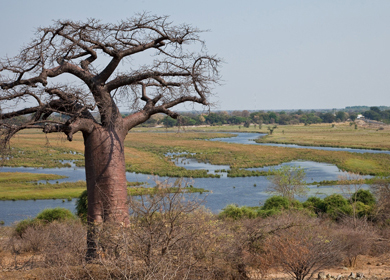
In the north east of Namibia, bordering Angola, Botswana and Zambia, the Caprivi region is a mosaic of woodlands, rivertine forests, swamps and rivers and home to an abundance of game and birds. Community campsites and joint venture lodges are set in amazing places.
The wildlife is protected by several reserves: Mamili, Bwabwata, Lizauli and Mudumu. There are no fences, therefore the animals roam freely across the borders of Namibia's neighbouring countries, Botswana and Zambia.
Caprivi land based activities include exciting game drives and walking safaris, while the tranquil waterways are ideal for game viewing by boat, canoeing and tiger fishing. Birdwatchers will have a wonderful time spotting more than 400 species of bird..
The Kunene Region of Namibia is a rugged and remote wilderness that captures the untamed spirit of Africa. Nestled in the northwest corner of the country, Kunene is a land of dramatic contrasts, where the parched Namib Desert meets the rugged mountains and verdant valleys. This region is a sanctuary for a wealth of wildlife, from desert-adapted oryx, to tiny desert chameleons.
The Kunene River, winding its way through this arid expanse, breathes life into the land, forming a natural border with Angola and creating lush oases amidst the stark terrain. The Epupa Falls, a series of cascades along the river, offer a breathtaking spectacle, with the thundering waters plunging into deep, rocky gorges surrounded by baobab trees.
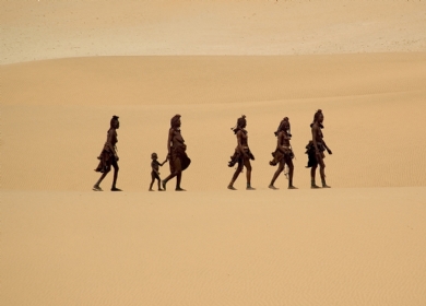
Kunene is also home to the Himba people, one of Namibia's most iconic indigenous communities. The Himba maintain a traditional, semi-nomadic lifestyle, herding cattle and goats, and adorning themselves with intricate jewelry and ochre body paint, which symbolizes their deep connection to the land.
Exploring Kunene is an adventure into the heart of Namibia’s wild beauty, where each journey unveils the raw and pristine character of the African wilderness. The region's remote lodges and campsites provide a gateway to an experience of solitude and connection with nature, far from the bustle of modern life. Whether trekking through the rugged mountains, navigating the expansive desert dunes, or marveling at the star-studded skies, Kunene offers a truly unforgettable escape into one of Africa’s last great wildernesses.
One of the driest places on earth, with some of the world's highest sand dunes, the Namib Desert experience is one which will remain in your memories forever. With the night skies being overwhelmingly pierced with stars, and the sunrises and sunsets casting the most gorgeous colours over the dunes, the Namib will enchant you in many ways.
Stretching about 1 200 kilometres along the west coast of Southern Africa, but only averaging about 70 kilometres in width, the Namib creates the most desolate of coastlines. It is unbelievable that anything can survive in these harsh sands, however, many fascinating creatures and plants eke out an existence from the little resources available.
Amazing too is that San Bushmen have tackled this environment for hundreds of years, and succeeded!
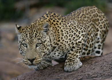
Situated halfway between the capital Windhoek and the Etosha National Park, the 55,000 acre Okonjima Game Reserve is the home of The AfriCat Foundation, which rehabilitates cheetahs, wild dogs hyenas and leopards. There are opportunities to see these beautiful carnivores in their natural environment.
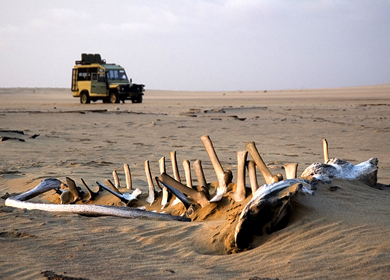
Taking its name from the skeletal remains which were found on the beaches from whaling and seal hunts, the Skeleton Coast has been known to generate its fair share of human bones too.
This harsh coastline has been the resting place of numerous shipwrecks, with the fate of the sailors being of unimaginable hardship.
Canyons, sand dunes and mountains make up the terrain of the area, with numerous species of wildlife surprisingly being found suriving the conditions.
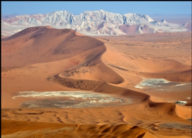
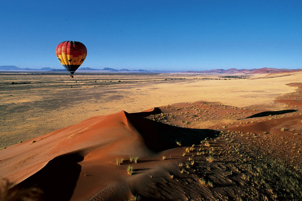
Situated in the largest conservation area in Africa (the Namib-Naukluft National Park), Sossusvlei is possibly Namibia’s most spectacular and best-known attraction. Characterised by the large red dunes that surround it, Sossusvlei is a large, white, salt and clay pan and is a great destination all year round. The dunes in this area are some of the highest in the world, reaching almost 400 meters, and provide photographic enthusiasts with wonderful images in the beautiful morning and evening light.
Southern Namibia, including the region around the Gariep River, presents a strikingly diverse landscape characterized by its arid beauty and dramatic geological features. This area is situated along the southern border of Namibia and extends into South Africa, encompassing a range of natural environments from rugged mountains to vast deserts.
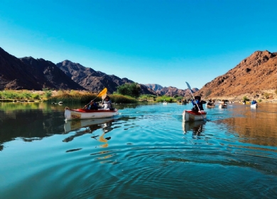
The Gariep River, also known as the Orange River, is a significant watercourse in this region, serving as a lifeline that contrasts with the surrounding arid terrain. The river creates a lush corridor of vegetation along its banks, supporting a variety of wildlife and providing vital resources for both humans and animals. The Gariep River Basin is crucial for agriculture in this otherwise dry region, with irrigation systems harnessing its waters for crop cultivation.
Southern Namibia features the Namib Desert, one of the oldest and driest deserts in the world, known for its expansive dune fields and striking landscapes. The region also includes parts of the Fish River Canyon, one of the largest canyons in the world, which offers dramatic vistas and unique geological formations. This area’s climate is generally characterized by low rainfall, high temperatures, and significant temperature fluctuations between day and night.
The region's sparse population is centered around small towns and settlements, where communities often rely on the Gariep River for essential water resources. Southern Namibia is also known for its rich cultural heritage, with local communities maintaining traditional lifestyles that are closely connected to the land and its natural resources.
Overall, Southern Namibia, with the Gariep River as a key feature, represents a blend of dramatic desert landscapes and vital waterways, showcasing the region's ecological and cultural diversity.
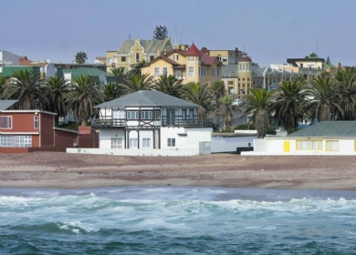
A delightful and historic old German town, Swakopmund is the recreation capital of Namibia, and offers an enormous number of ways to enjoy the surrounding Namib Desert, as well as the Atlantic Ocean.
Founded as a harbour for the Germans during their colonial ownership of South West Africa, Swakopmund is closely connected with marine activities and wildlife. Some fantastic seafood can be enjoyed in one of the many restaurants.
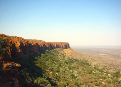
Waterberg Plateau Park is a national park in central Namibia encompassing the Waterberg Plateau, 68km east of the town of Otjiwarongo. The Waterberg Plateau is a particularly prominent feature, elevated high above the plains of the Kalahari of Eastern Namibia.
The plateau and some 405 km² of surrounding land were declared a Nature Reserve in 1972. The Waterberg Plateau Park is ecologically diverse, rich and has over 200 different species of bird and some rare species of small antelope on the lower hills of the mountain.
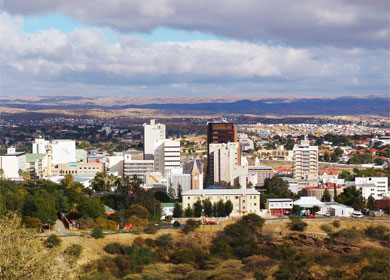
Windhoek is the capital city of Namibia and is the major destination for international flights to the country.